
Oceanum Datamesh
The Oceanum.io Datamesh is an cloud service for interacting with environmental data. It facilitates the discovery, management, and utilisation of all types of environmental datasets. You can access existing data in our extensive catalog or connect your own data. The Datamesh provides core functionality to facilitate the building of environmental data science workflows, pipelines and end-user applications.
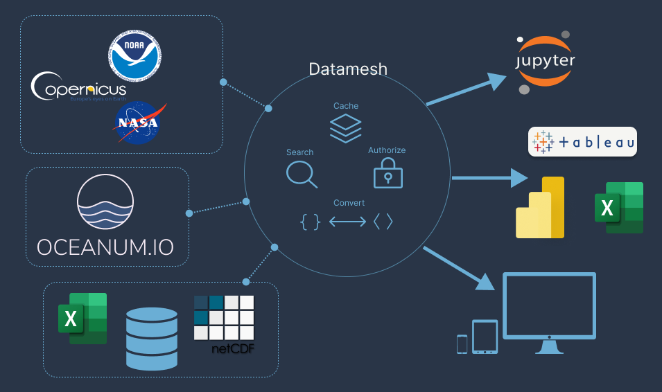
Features
-
Searchable catalog - Spatial, temporal and natural language searching of all datasource metadata on the datamesh.
-
Query capability - Filtering and subsetting datasources to extract only the required portions of large datasets.
-
Authentication - User and organisation based authorization to allow fine-grained control of datasource access including sharing with other users.
-
Performance optimisation - Partitioning, caching and lazy execution of operations on datasources allow rapid access and pipelining of massive datasets.
-
Format conversion - Datasources can be accessed in a wide range of community standard formats regardless of their underlying Datamesh storage formats.
-
Data access APIs - Community standard REST APIs to connect to datasources for data access or application integration.
-
Aggregation operators - Calculation of aggregated quantities (for example mean or sum) within the datamesh, next to the data.
-
Optional storage - Data can be stored on the Datamesh or left on existing data services. The Datamesh provides a connection to these services and a common interface to access them.
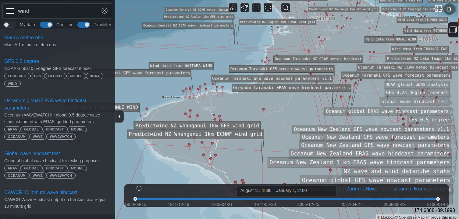
Datamesh UI
The Datamesh service has a fully featured User Interface that allows you to search, discover and access data. You can also manage your own data and share it with other users. You can interact with the datasources on the Datamesh using a map view or a drive style interface.
What makes it different?
The Oceanum.io Datamesh is not like a standard data warehouse, data lake, database or GIS server and has two key differences to many existing data platforms:
-
First-class support for data structures found in the environmental and earth sciences. This includes multi-dimensional datacubes that vary in space, time and other dimensions as well GIS raster and feature layers and standard data tables. For example weather forecast models or climate projection data.
-
Data stored on existing data services is left where it is under the direct management of the data owner or provider. The Datamesh makes a connection to these third-party servcies and provides an access layer managing searchability, authentication and connectivity. However a storage system is provided for users wishing to store their data in the Datamesh cloud, but this is not a requirement to utilise the Datamesh.
Read more about how the Oceanum Datamesh works